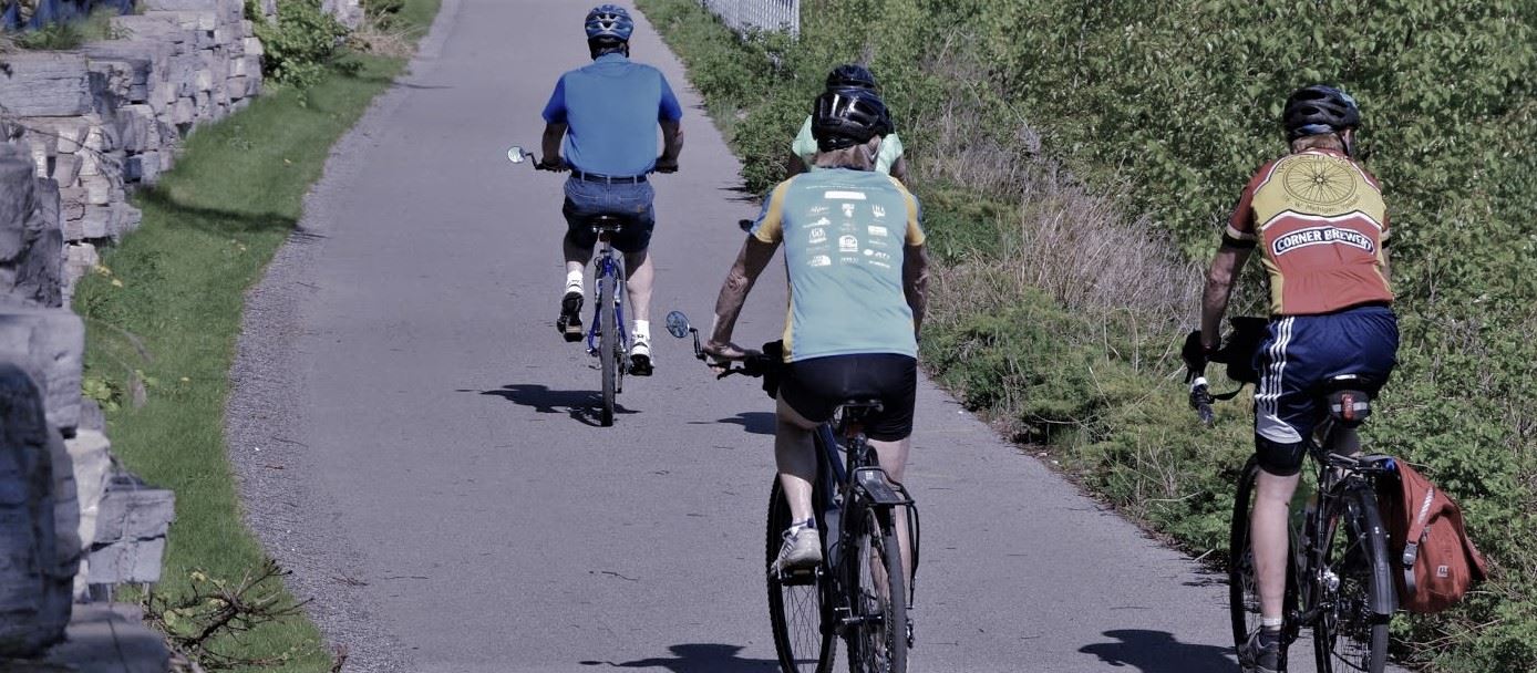
There is
an active group of mountain bikers in the Ann Arbor Ski Club
that goes out twice a week: Friday evenings and Sunday mornings. Click here
for the current schedule. This page has directions to the trails. For up-to-date
listings of other events, see the Michigan Mountain Biking Association web
site: www.mmba.org
For the rides in state parks, you need a pass. Most of us get season passes.
You also need a pass for the Metro parks.
Island
Lake
Meet at the trailhead parking lot in the Island Lake State Park. To get to
Island Lake, take the Kensington exit from 96 S. for less than a mile to the
park entrance. This has two loops: one is 9 mi, one is 5 mi. They are less
hilly than most of the other rides and have some long straight sections (well,
long and straight by mountain bike standards, anyways) where road bikers can
show off their superior conditioning.
The
Poto (Potowatomi Trail)
Pinckney Recreation Area (state park). The park is NW of Dexter, on Dexter-Townhall
Rd a mile or so N. of Territorial Rd. This ride has several loops, ranging
in distance from 5 mi to 18. We normally do an 8-mi or 14-mi loop (often we
split into smaller groups at the cut-off point for the 8-mi return loop). This
trail was developed for overnight hikes over 20 years ago, and is now one of
the most established mountain bike trails in the state. It is more hilly than
most of the other rides. It is also rockier and rootier than most, making it
one ot the more challenging rides.
SILVER LAKE parking lot. This is where we usually meet (unless the schedule
says otherwise.) To get here, take N. Territorial Rd. west to Dexter Town
Hall Road, then North to the Silver Lake Entrance to the Pinckney Recrreation
Area. Meet in main parking lot (1st one with a lot of bikers).
HALF MOON LAKE parking lot. To get here, take N. Territorial Rod.
west to Hankerd Road, then north to the Half Moon lake Entrance to the
Pinckney Recreation Area. Meet in the first parking lot.
Brighton
(Bishop Lake)
Meet at the Bishop Lake (state park) parking lot, just S of Brighton. From
US 23, take the Lee Rd exit west Whitmore Lake Rd. Go S. on Whitmore Lake to
Maltby, W. on Maltby to Hamburg Rd. Go left (S) for a few hundred feet to Baur
Rd. Turn Rt. on Baur. In a mile or so there is road to the left marked Bishop
Lake. Turn left onto it, and follow for a few miles to the Bishop Lake state
park.
This area has the most new trails. Beside the "classic",
there are two new trails: Torn shirt is 5 miles of hills and tight turns.
Murray Lake is a little over 6 miles. It is turny but not as hilly as Torn
Shirt.
Maybury
Meet at the main lot for Maybury State Park from 8 Mile Road, a few miles west
of Beck Road.(Do Not park in the lots off of Beck Road near the horse staging
area.) Get to 8 Mile Road from Beck Rd. off of M-14 or I-96. This 4.5-mi
trail is a little hilly and a lot turny.
Hewen's
Creek Park
To get to the park, take I-94 to the Huron Street Exit #183 (next to
the Visteon Plant and Ford Lake). Go south until Stoney Creek Rd and
turn right on Stoney Creek. Just past Rolling Hills Park, turn left
on Bemis road and look for the small white Hewens Creek sign about
a half mile down. Right now, there are only about four parking spots
at the trail head. We have been given permission to use Lincoln High
School's parking lot which is at the corner of Bemis and Hitchingham
roads. This is a great option as the lot is big and it is only about ¼ mile
from the trail head. Meet here and we'll bike to the Park.
The
Northeast (New) Loop
Meet
at the parking lot located just inside the entrance to Bandemeer Park
at the intersection of Barton Drive and Whitmore Lake Road, right
off the M-14 expressway at the Barton/Whitmore Lake exit. (The
map is courtesy of www.MapQuest.com.)
The NE Park loop is one of our more moderate rides, but
it still provides a good workout. It covers an amazing amount of
forest trails, mostly within the city limits of Ann Arbor.
View a detailed map of the NE park, with all
four loops.
Bluffs
Park (the "Classic") Loop
The Bluffs Park loop is our more challenging Ann Arbor ride. It includes
some steep climbs and descents along the valley wall of the Huron
River. It begins by heading south through Bandemeer Park along the
Huron River to Summit Street, the into Bluffs Park. This area
contains a myriad of highly technical trails and some interesting
hills. After Bluffs Park, the trail becomes easier, passing under
M-14 and crossing Kuebler-Langford Park to reach Huron River Drive
and the entrance to Barton Park. The trail then crosses the Huron
River, meanders through the oxbow, heads north to the Barton Pond
dam and eventually back to the Bandemeer Park parking lot.
Highland
Recreation Area
Meet at the Livingston Road parking lot for the Highland state park. Although
you don't go through an obvious park entrance, a state park pass is required
to use the parking lot. Take M59 E from US23 for about 10 mi to Duck Lake Rd.
Take Duck Lake S. about a mile to Livingston Rd, go west (right turn) on Livingston
for a few hundred feet to the parking lot on the N. side of the road. This
has four loops (A, B, C, and D). It is hilly and turny, rocky and run. Rides
can be as short as 3 mi, or as long as 18 mi.
Pontiac
Recreation Area
Pontiac has been re-worked in the past few years and gotten rave
reviews from some of our bikers. The 11-mile mountain bike trail
has been ranked as one of the "Top 100 Trails" in the United
States. To get to the park from M-59, drive north on Williams Lake
Road then turn left on Gale Road. Follow the signs to the entrance.
Holdridge
Lake (Holly Recreation Area)
Turny, and big log piles (that have nice ramps and are easy!). There
are several loops, ranging from beginner to "interesting." Go
North on 23 to exit 78 Fenton, then East through Fenton to Grange
Hall Rd. Take Grange Hall Rd East about 5 miles. Just before you
would cross I75, turn North on Hess Rd and follow it to the trailhead.
This is the Holdridge Lake part of the Holly Recreation area.
Kensington
Metro Park
Meet at the Bay Woods parking lot in the Kensington Metro Park. Take the Kensington
exit from 96 N. to the park entrance. This ride has many options, covering
technical woods trails, local dirt roads, and someday-to-be-cut trails. You
pretty much have to learn it with someone who already knows the area.